GEOGRAPHIC DECIMAL DEGREES
SCALE 1:50,000,000
Click on any image.
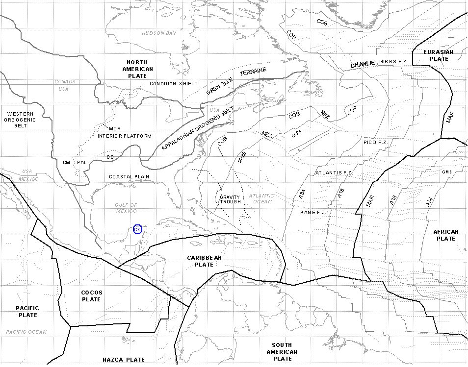
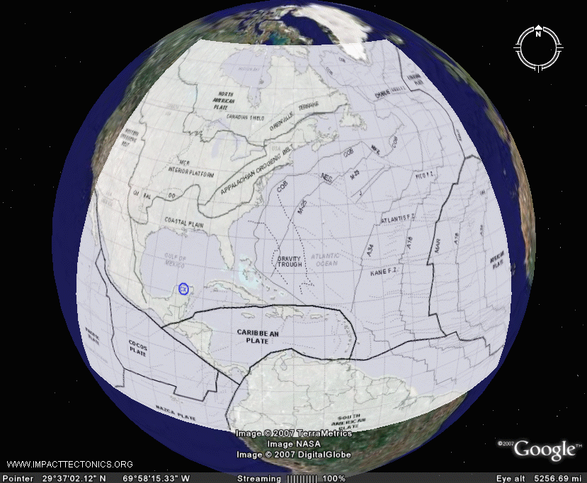
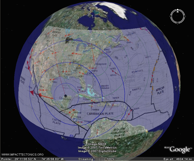
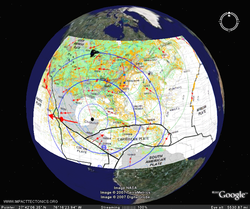
MAP 1. Ocean and continental physiography,
crustal plate boundaries, and magnetic isochrons in the
Central Atlantic region, Google Earth rendition to the right.
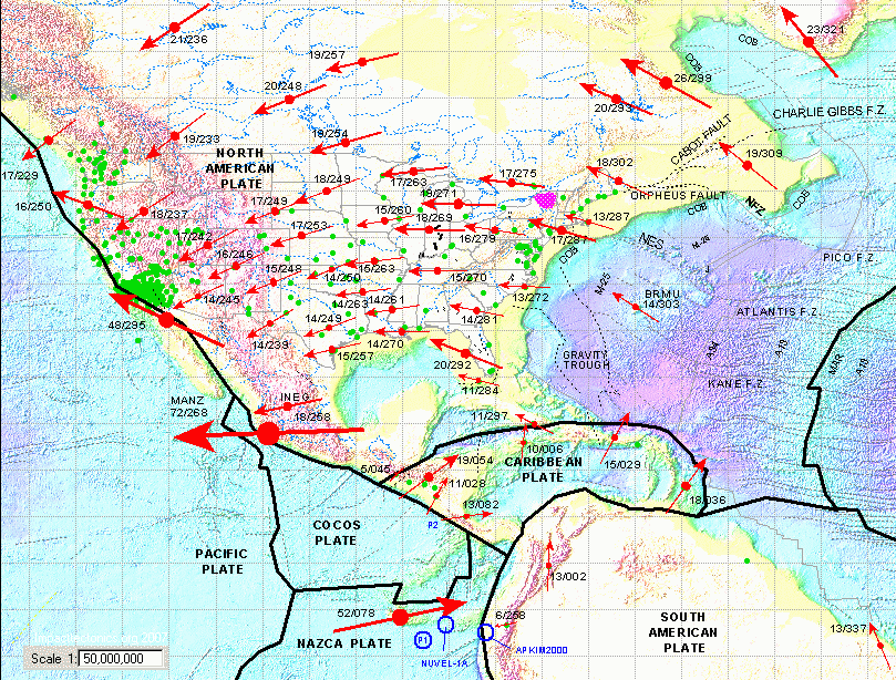 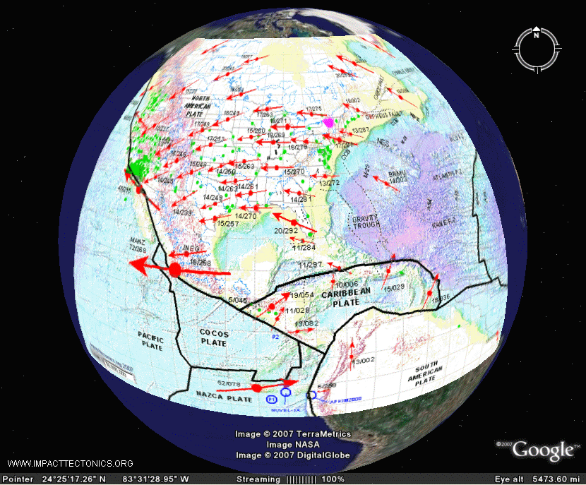
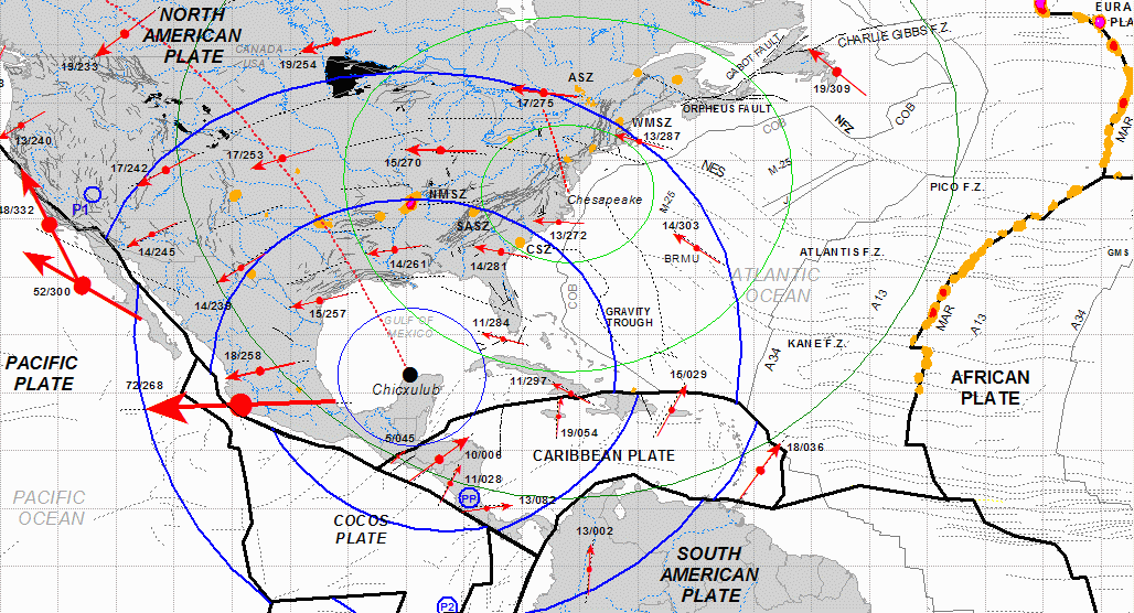
MAP
2. Ocean and coninental colored
physiography, crustal plate boundaires, crustal seismic
zones, crustal-plate horozontal velocity vectors based on GPS readings
over the past 12 years,
and North American continental rivers . Physiographic base isUSGS TIFF image.
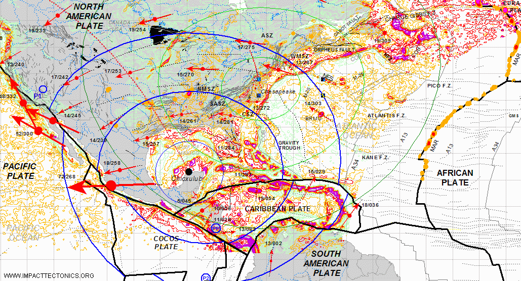
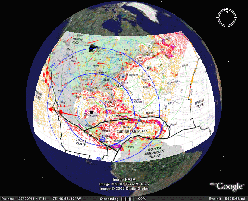
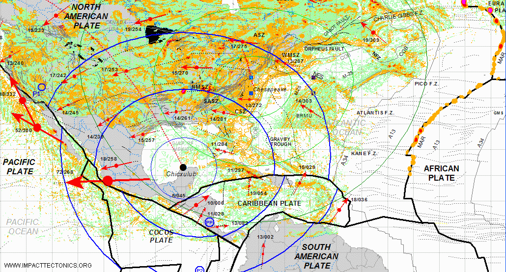
MAP 3. Continental polygons, tectonic plate boundaries, rivers
and lakes (ESRI), line traces of
ocean-floor lineaments, crustal faults (USGS), GPS horizontal
component of crustal plate motion
( NASA-JPL), crustal seismic zones and impact architecture showing
660, 1700, and 2900 km rings
representing crests and troughs of crustal welts.. Principal axis of
compression extends foreland of
the impact craters in line with bolide oblique-impact
trajectories.
MAP 4. DNAG Bouger Gravity equipotential
contours with data from MAPS 1-3.
MAP 5. DNAG Aeromagnetic equipotential
contours with data from MAPS 1-3.
 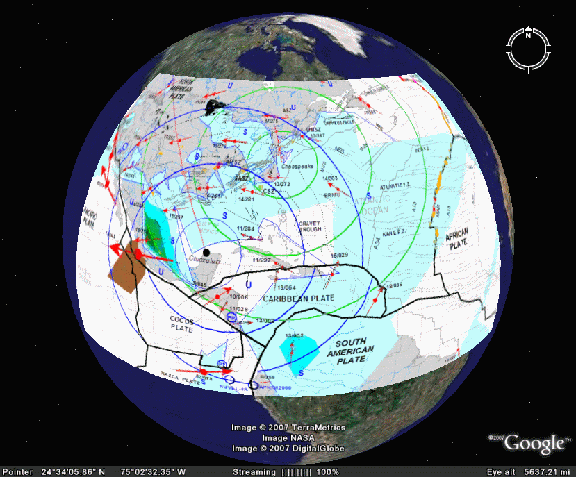
MAP 6. GPS vertical crustal motion represented
with TIN surface of equipotential vertical velocity
(NASA-JPL) with other map data from MAP 1-3. Continental regions
of uplift (U) and subsidence (S)
reflect overlapping and interfering ring structures stemming from the Chicxulub
(~65mya) and
Chesapeake (~35mya) impacts. |