Click on an image
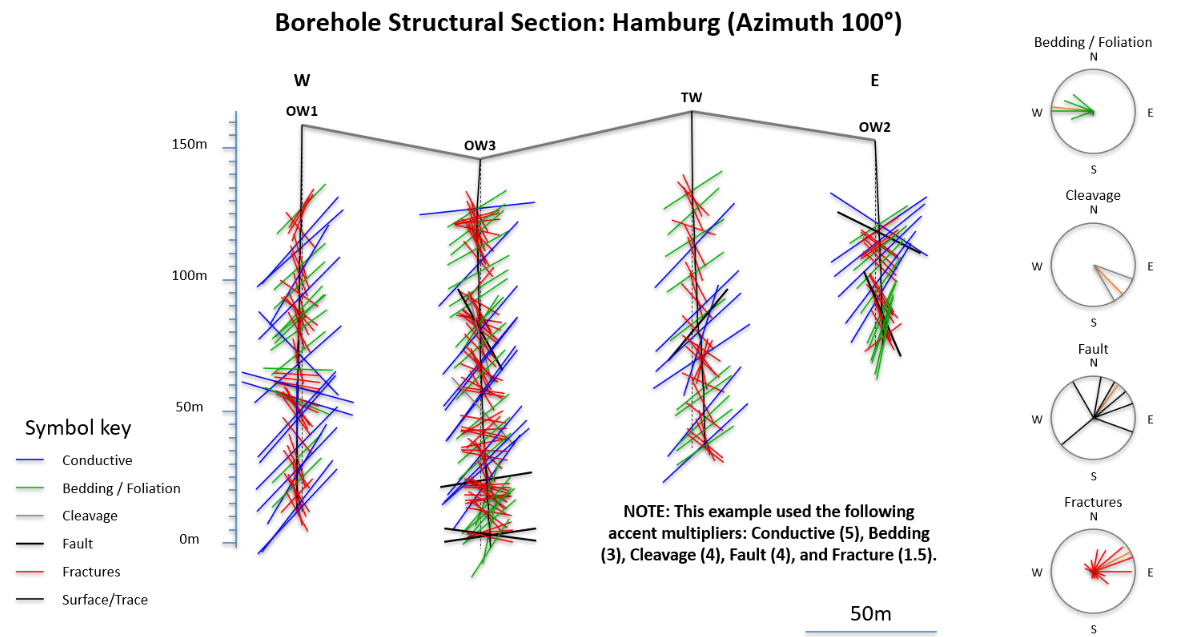
BoreholeSectionPro (50 MB)
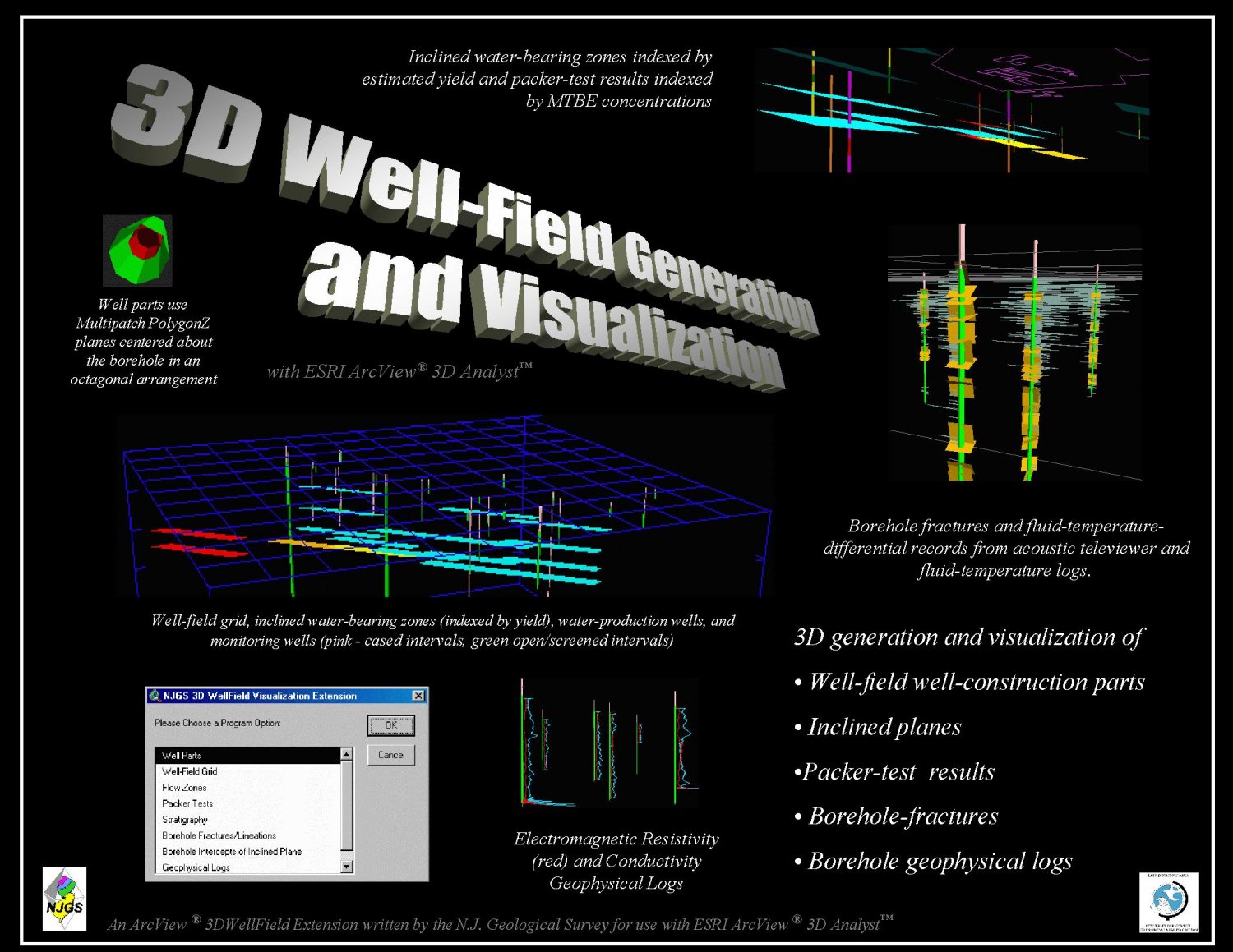
Poster showing aspects of the NJGS ArcView 3.x extension for 3D Well-Field Visualization. GIS application by the NJ Dept. of Environmental Protection 2001.
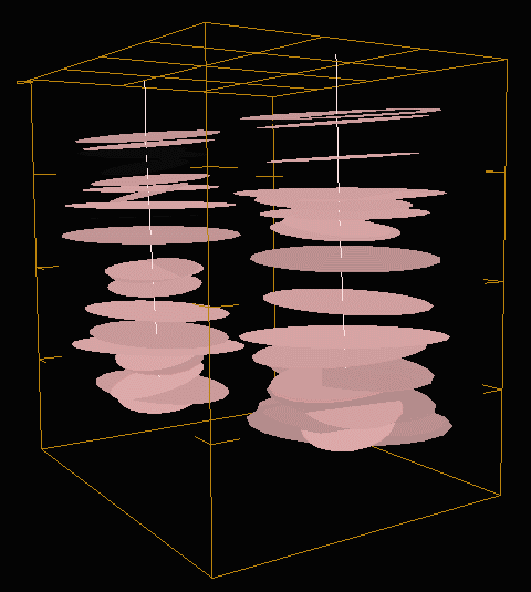
Virtual Reality Models of bedrock strata and fractures from borehole telviewer data
2008 Oct 16