![]() ARCHEOLOGY
BLOG Rev.
01/10/2022
ARCHEOLOGY
BLOG Rev.
01/10/2022
Gregory Charles Herman,
PhD
Flemington, New Jersey,
USA
|
A Nasca hillside ceremony site was seen
while conducting a systematic, Google-Earth based inventory of the Nasca
Lines in 2020 as part of a Geological Society America conference
video
presentation on the hydrogeology and tectonic nature of the Nasca
Lines (fig. 1). This unusual hillside complex was introduced towards the
end of that work, and is further mapped and discussed here. Click on an image to enlarge it. 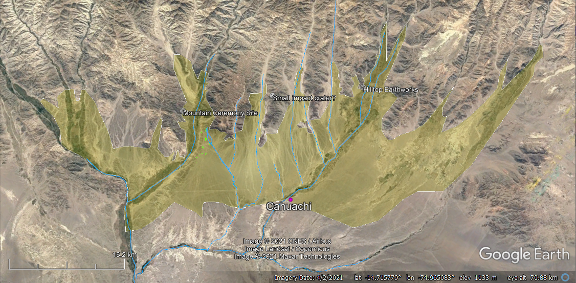 Figure 1. The area highlighted yellow covers nearly
800 sq. km or 2000 acres of the Peruvian pampas where Earth was worked
by the Nasca people at the dawn of the Common Era about 2000 years ago.
The alluvial valleys continue to be farmed today. Figure 1. The area highlighted yellow covers nearly
800 sq. km or 2000 acres of the Peruvian pampas where Earth was worked
by the Nasca people at the dawn of the Common Era about 2000 years ago.
The alluvial valleys continue to be farmed today. |
| A unique set of geoglyphs sit atop a foothill
at about 600 m elevation overlooking the Nazca plains to the South (fig.
1). The landscape holds many large geoglyphs portraying priestly deities
and some floating heads (figs. 2 to 4). The ceremony
site is flanked on both sides by hilltop ruins that mark likely viewing platforms
where spectators could watch the ceremonial games unfold. Together,
these glyphs and ruins belie the relative societal importance of this
sporting site during the Nasca monumental period. The site may
have been the main competition grounds that complimented Cahuachi, the
religious and cultural center of the Nasca located about 19 km due
south (fig. 1). A 2014 historical image from Maxar Technologies available in the GE historical imagery shows the clearest details that stock GE imagery provides at this time (fig. 2). Another image of the site was obtained using NASA's WorldWind Earth globe with Microsoft BING imagery in 2020 that made the geoglyph forms a little more clear (fig. 3). It shows an owl effigy spanning the playing field, but better aerial imagery is still needed to thoroughly characterize the more obscure glyphs. |
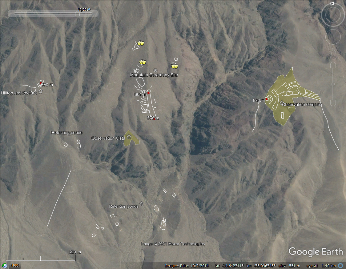
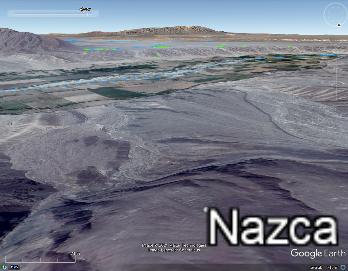 Figure 2. Left - Google
Earth 2014 aerial image of the hillside ceremony site located just
north of Rio Ingenio. The site is centered between an observation
complex lying about 300 meters east that had monumental architecture. A
hilltop with architectural foundations also lies immediately to the
west, and many water-retention ponds litter the hills on paths leading
to the site from the south. Right - The southern view from the ceremony
site overlooks Rio Ingenio and the perched Nazca terrace.
Figure 2. Left - Google
Earth 2014 aerial image of the hillside ceremony site located just
north of Rio Ingenio. The site is centered between an observation
complex lying about 300 meters east that had monumental architecture. A
hilltop with architectural foundations also lies immediately to the
west, and many water-retention ponds litter the hills on paths leading
to the site from the south. Right - The southern view from the ceremony
site overlooks Rio Ingenio and the perched Nazca terrace. |
| Raised, stepped, platforms heading up the central field on the north side may have been the throwing platforms, or perhaps, royal 'box seating'. But a more likely venue for a privileged class to watch the sport was from across the valley to the west where the ruins of a hilltop complex with old foundations and semi-circular, raised benches facing west to look out on the ceremony site from about 300 meters distance (fig. 2). |
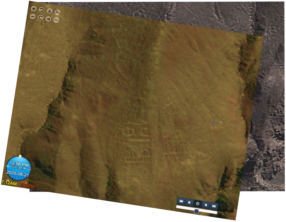 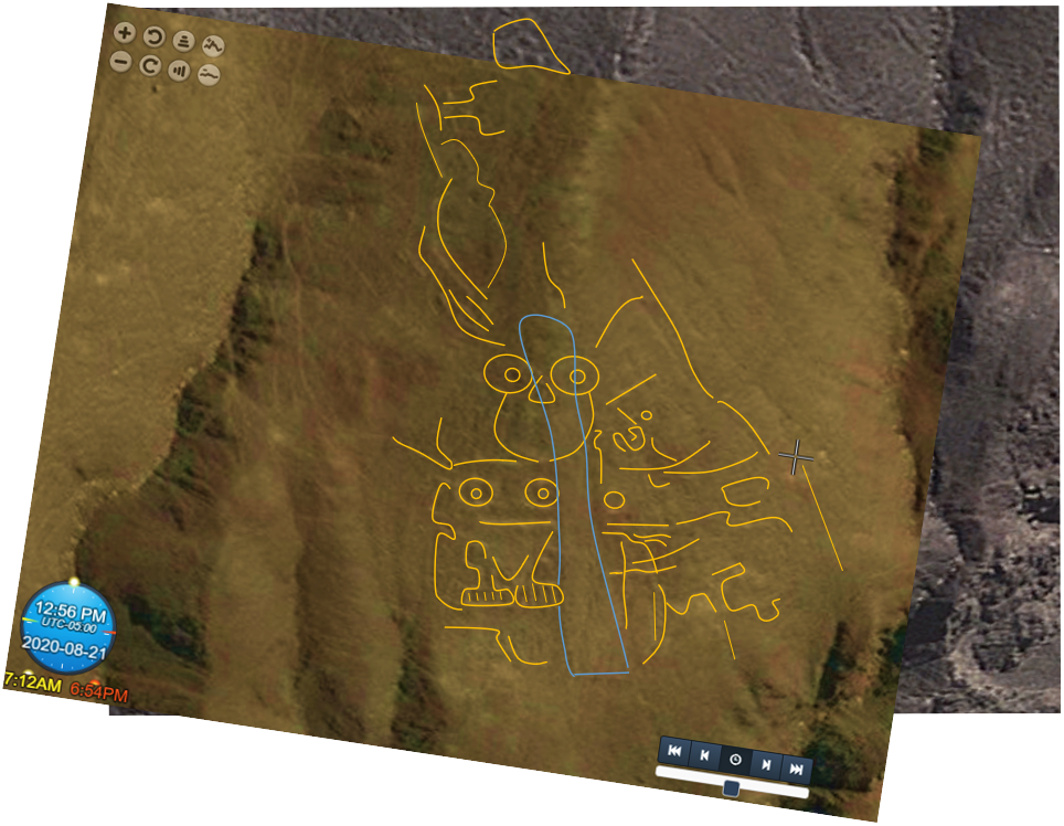 Figure 3. Microsoft BING aerial imagery from NASA's WorldWind globe was captured and embedded in a GE project for tracing the geoglyphs. |
|
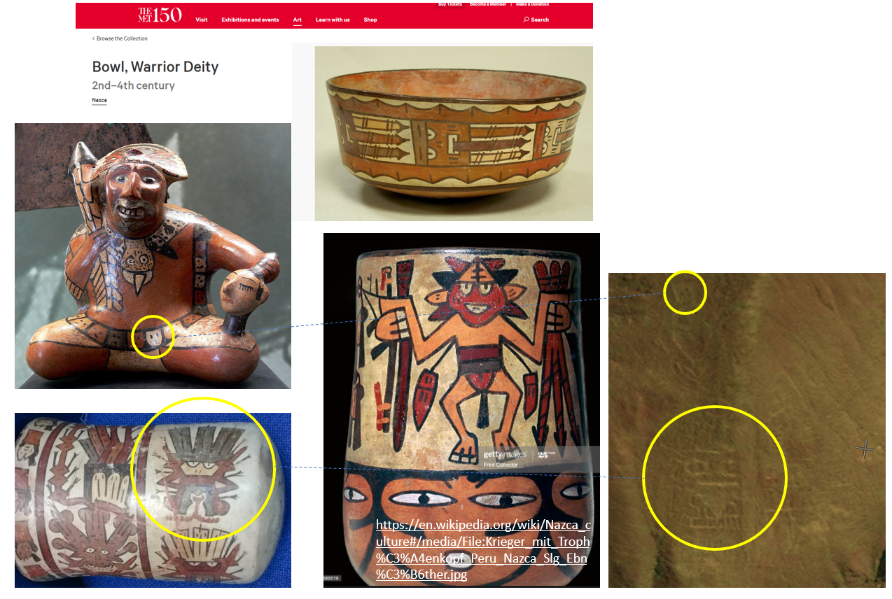
Their collective form, although incompletely depicted here, raises interesting questions regarding interaction of the Nasca with the northern Peru Moche during their monumental societal stages, because this Nasca Oculate Being and Owl are depicted together in a ceremonial setting, similar to iconic depictions of the Moche Warrior and Owl Priests.
Figure 4. Nasca depictions of warriors, warrior deities, and their battle arsenal on ceramics share thematic similarities with the mountain geoglyphs. |
| The design of battle-clubs, taking of
trophy heads, and priestly habits appear similar to those of the Moche
who used more elaborate and descriptive ceramic iconography like that
depicting an Owl Priest serving a chalice of blood taken from a captive
(loser?) to the high Warrior Priest (fig. 3). Towards the end of the
Nasca society, decapitations were commonplace and helped control
overpopulation during famine periods as their aquifers slowly became depleted from prolonged
drought. |
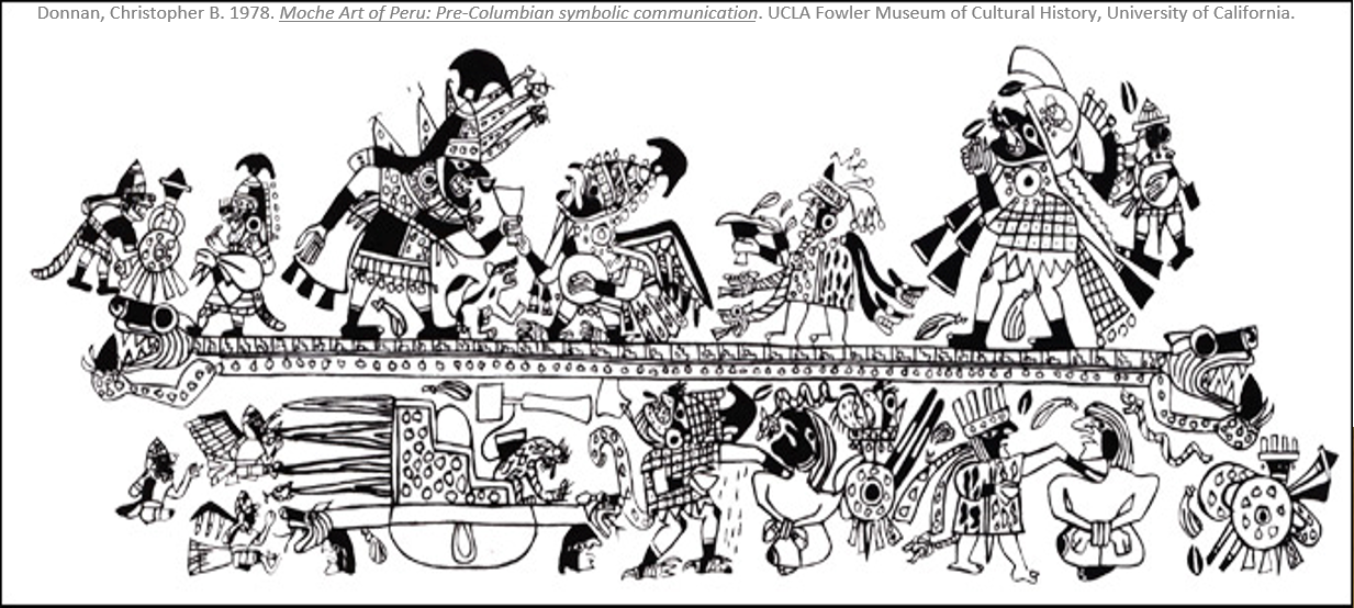 Figure 5. Moche ceremonial
scene showing an Owl priest serving a chalice of blood to a Warrior
priest. Figure 5. Moche ceremonial
scene showing an Owl priest serving a chalice of blood to a Warrior
priest. |
| Note how the central throwing field resembles the polygonal battle fields depicted on Moche water bottles, having warriors and battle clubs centered in context about the trapezoidal competition venues, sharing geometric similarity with some campo barridos (polygon-shaped fields) situated atop the Nazca aquifer. |
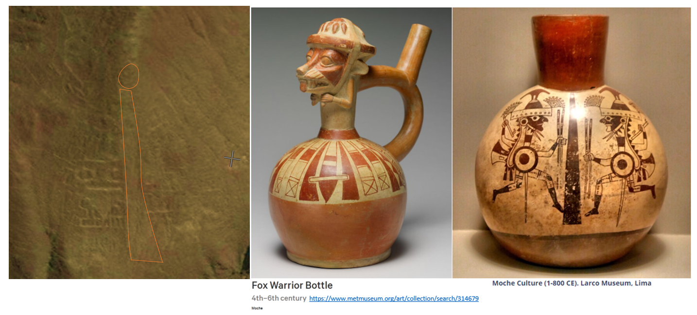 Figure 6. Water
bottles were essential for competitors as they worked up thirsts from
physical exertion. Their rendering on ceramic bottles mimic the forms
crafted into the
hillside. The field is about 90 meters in length and pitches down slope
30 meters along azimuth 168o. Figure 6. Water
bottles were essential for competitors as they worked up thirsts from
physical exertion. Their rendering on ceramic bottles mimic the forms
crafted into the
hillside. The field is about 90 meters in length and pitches down slope
30 meters along azimuth 168o.
|
| Based on the shared, iconic depictions, the nature of the competition likely involved two competitors using atlatls to throw rigged darts at feathered shuttlecocks, know today as 'Moche toss' as depicted in their art (Donnan, 2019). It's interesting to me how they utilized a site with such a drastic pitch to heave their darts downhill, thereby increasing hang time. It must have been thrilling to watch, with so much hanging in the balance. |
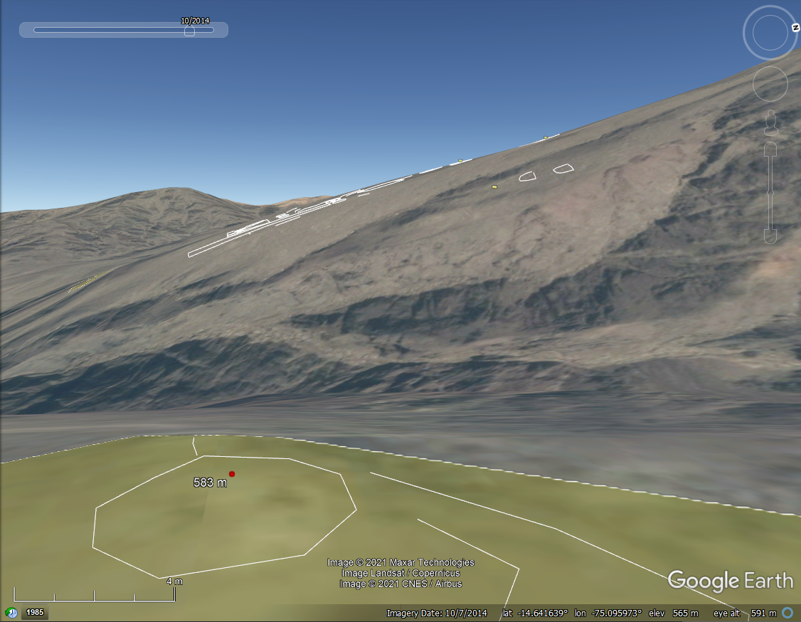 Figure 7. Western view of the sporting venue from across a small
valley at about 300 meters distance. The 583 meter spot elevation marks
the center of an undocumented foundation. Figure 7. Western view of the sporting venue from across a small
valley at about 300 meters distance. The 583 meter spot elevation marks
the center of an undocumented foundation. |
| Reference: Donnan, C. B., 2019, Bringing Back Moche Badminton: Archeology May/June issue. |