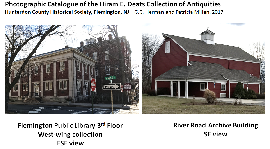
|
 2022
Short video
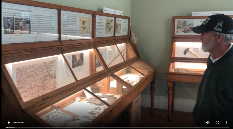
showing the newly renovated Hunterdon County Historical Society, 2022
Short video
showing the newly renovated Hunterdon County Historical Society,
Deats-Thatcher Indian-artifact collection and interpretation in the
Flemington Public Library (2nd floor).
 2022 Aspects of a Nasca Hillside Ceremony Site used for 'Moche Toss'
Stone mounds atop Cushetunk Mountain: Archeological Association of
New Jersey Zoom Presentation
2021-10-17
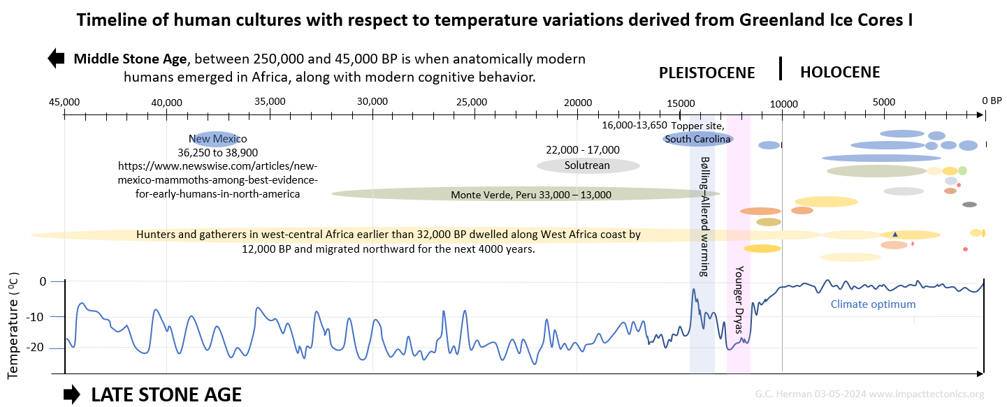
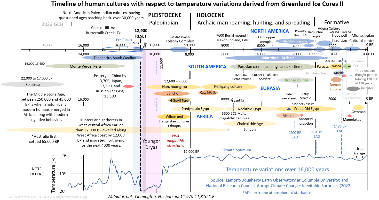
Paleo-Indian
Clovis point GH1 found along the Susquehanna River North Branch
2021-10-16
Some physical aspects of the Giza pyramids:
Old-Kingdom Science and Engineering
021-01-16
877MB mp4 Geological Society of America
14-minute Nazca-Line video
2020-11-03
The
hydrogeological and tectonic nature of the Nazca Lines 2020-10-29

 Lambertville Sill, Hunterdon County pre-Industrial hilltop
quarries;
LiDAR hillshade maps,
Lambertville Sill, Hunterdon County pre-Industrial hilltop
quarries;
LiDAR hillshade maps,
GPS tracks, and
site photos with Martin Rapp,
Mark Zdepski, and Tom Albanese.
2020
Visit to Gary Fogelmann's (PA) personal collection of American
Indian artifacts 2020
Cataloguing Ed Fimbel's Indian artifacts collected in the
Schuylkill
River, PA watershed 2020
Round Mountain
LiDAR hill-shaded maps, site photos, and geological interpretation
2020
 Abbott Farm National Historic
Landmark , Trenton, NJ 2019
Abbott Farm National Historic
Landmark , Trenton, NJ 2019
pXRF
2019tested rocks and stone, data and documents
pXRF 2019 Photos of tested rocks and
stone hand samples
pXRF
2019 Photos of rock outcrops and
settings of tested rocks and stones
Rosenkrans Adena Mortuary
Complex, Wallpack Bend, NJ,
Maps and site photos
2019
Flint Ridge and Buckeye Lake
Museum, OH, Maps and site photos
2019
Meadowcroft
Rock Shelter, Pa., Site photos and video 2019-08
Milford Bluffs, NJ Photos with Mark Zdepski, Ed Fimbel, Ben
Brander, and Jacob Buxton 2019-05
Stoney Ridge, Palmerton, Pa.,
LiDAR Hillshade Maps, site photos and field notes of J. Mark
Zdepski. 2019-05
Gaddis Run argillite
Quarries and Jurassic Byram sill 2019
2019-01 Bachmann House,
Easton, Pa., Lenape Nation of Pa., Cultural Center artifact displays
2018-10 Rattlesnake
Hill Iron Mines, Pa., LiDAR Hillshaded Maps and site photos
2018-10 Vera Cruz Jasper Pits, Pa., Maps and
site photos
2018
Indian-artifact places and photos from local collections in Upper Argillite Alley (NJ-Pa)
KMZ
2018-09 Walters Nursery, Point Pleasant, Pa., Artifact
photos
2018-04 Raritan Township, NJ Municipal Building Artifact photos
2019-01 Cushetunk Mountain NJ Highlands 2007
Hillshaded LiDAR Maps
2018
Cushetunk Mountain DJI Drone tiled photoimagery with Ben Brandner
2018 Old Stone Cairns on Cushetunk Mountain,
NJ Photos, Maps, and KMZ
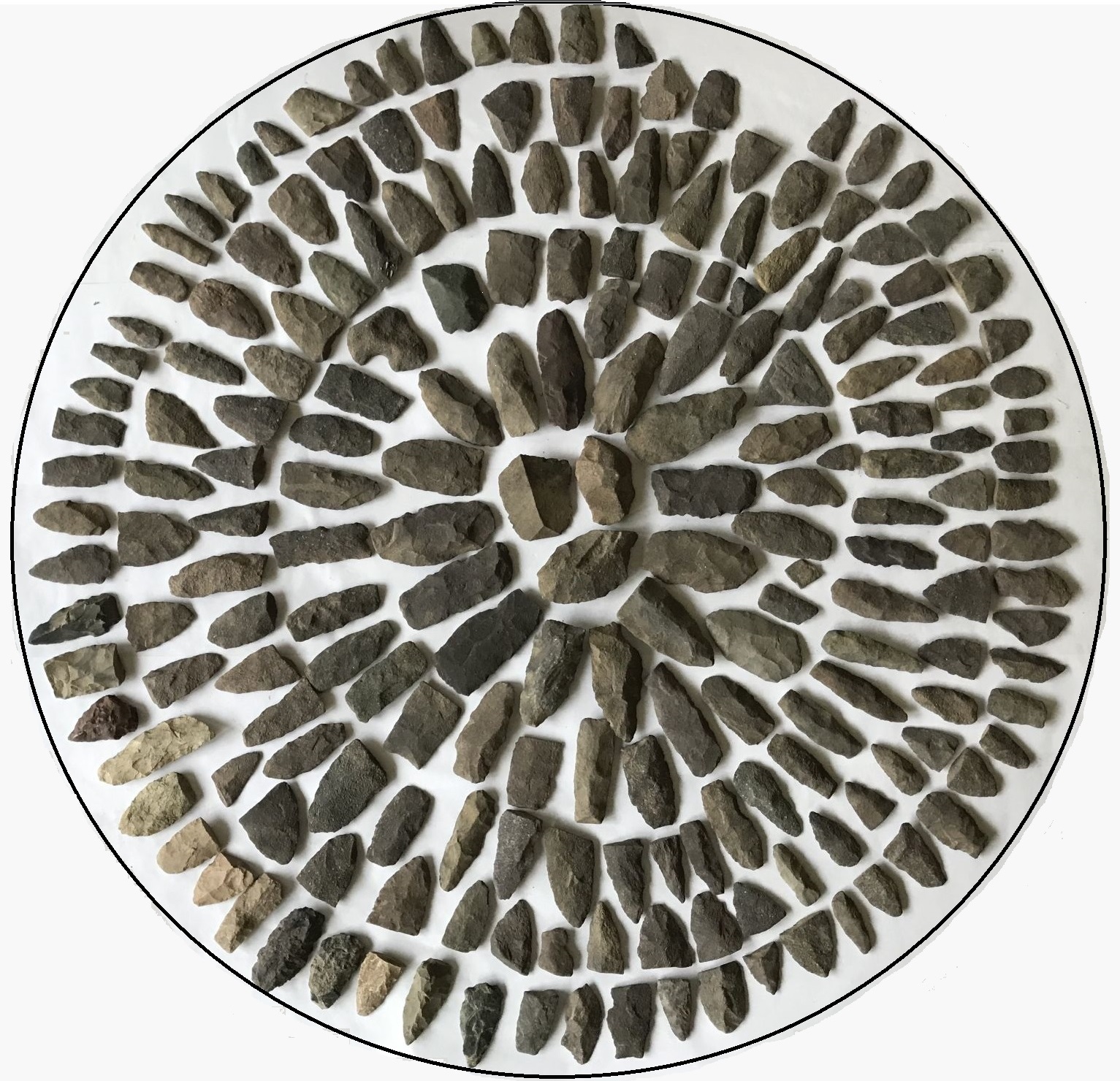
2018 Hunterdon
County Historical Society Artifact Photos Cabinets
2
*
3
*
4
*
5
*
6 *
7
2017-12 Kingwood Township Municipal Building Artifacts from the
DeRewal Site, RT. 29, NJ, Photos
2016-05 Nazca Lines, Peru Maps and KMZ
2008 Video of The Old Neshanic Copper Mine in Flemington, NJ *
1 *
2
|