TECTONICS BLOGS
 GEOARCHEOLOGY
IMPACTTECTONICS.ORG
TECTONICS BLOGS
GEOARCHEOLOGY
G.C. Herman, PhD 2026-10-17
2026 Earth Astrobleme Atlas GCH Rev. 1.0
A Google Earth KMZ file with mapped, known and
suspected astroblemes on Earth
 2026
EarthAstroblemeAtlasGCHRev.1.0.kmz
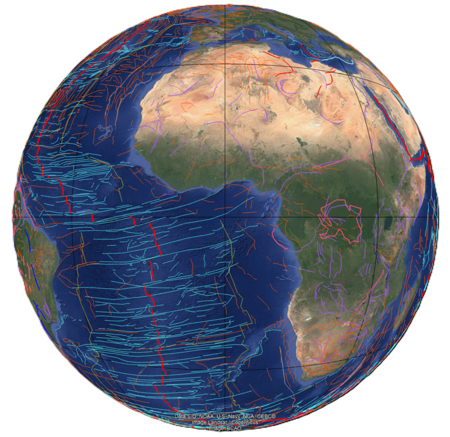 2026
EarthTectonicsIllustratedGCHRev.2.0.kmz
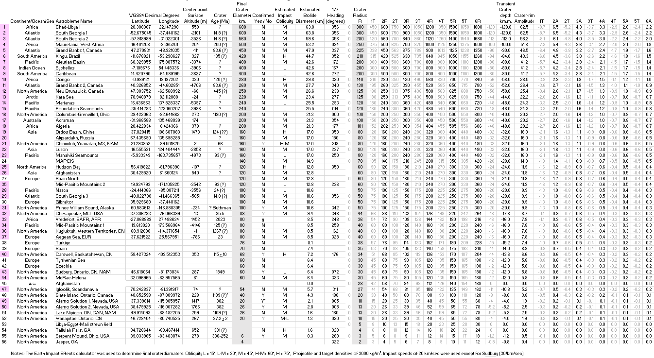 2026MSExcelTableofKnownandSuspectedEarthAstroblemes.xlsx
Summary
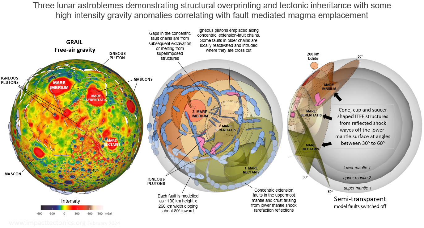
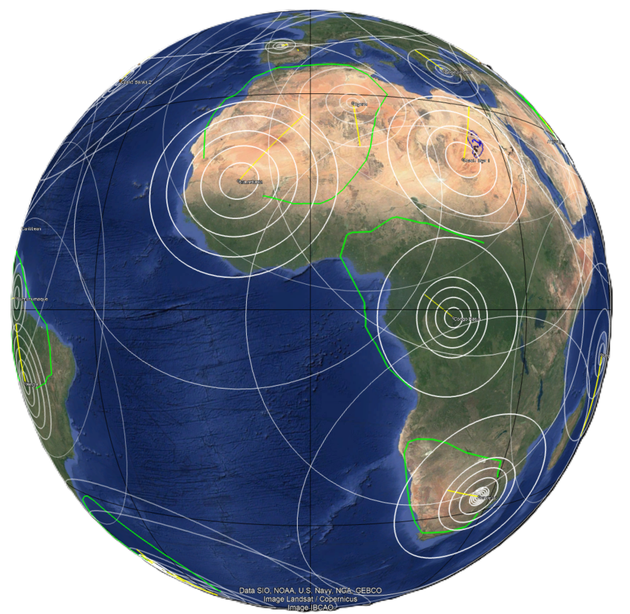
This work demonstrates how large, hypervelocity bolide (asteroid and comet) impacts help shape Earth's surface. Known and suspected astroblemes are mapped and compiled here using the Google Earth Pro (GE Pro) and Microsoft (MS) Excel computer programs. An astrobleme is a 'star wound', or the strain field in the crust and upper-mantle surrounding a large-meteorite or comet impact crater. Each astrobleme is mapped around the center point of a final crater using concentric rings and radial, impact-tectonic, far-field (ITFF) structures. The ITFF structures are mapped using GE Pro and QGIS and include crustal faults observed in satellite imagery and linear geophysical anomalies seen in magnetic and gravity global themes. The astrobleme names, locations, and impact parameters are compiled in table 1 (MS Excel workbook), with the largest listed at the top and decreasingly smaller ones following in order. The KMZ file is organized using known and suspected subdirectories having other subdirectories for each named astrobleme. Global geophysical themes are used with Earth Survey's custom, ring-generating application to help portray the crustal expression of each crater and multi-ring impact basin, most of which are only suspected and await field verification. But the strain effects are clear and resemble those ITFF structures seen on Mars and the Moon. This work uses the WGS84 geographic coordinate system (decimal degrees) and kilometer distances.
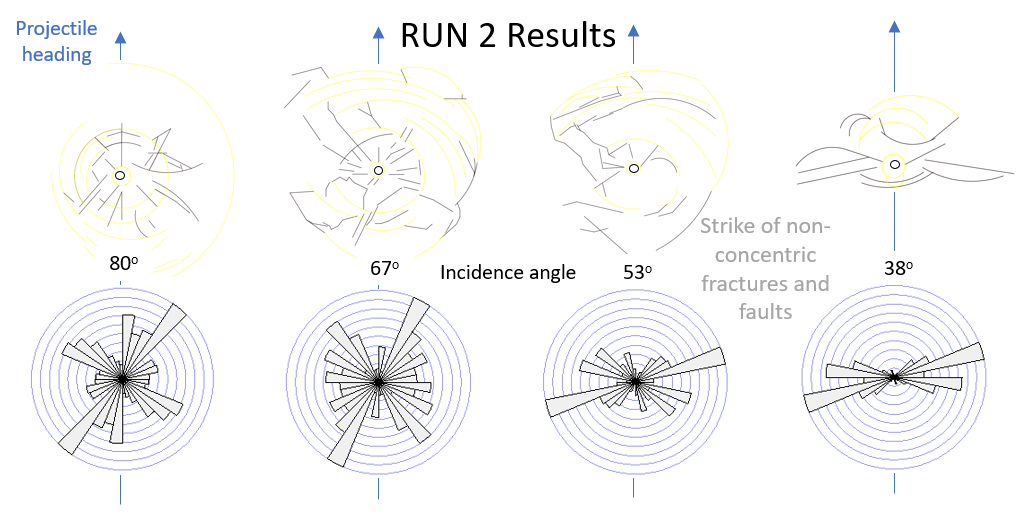
Most meteorite and comet impacts are oblique with respect to the planets surface, as the chance of a normal-incident one is 1/90. Because of the uncertainly of deducing the obliquity component of the projectile trajectory, three ranges of impact angles are used that include high (>60o), moderate (30-59o), and low (<30o) angles . Laboratory experiments and the aforementioned analyses of the Moon and Mars astroblemes help constrain these interpretations. For example, low-angle impacts commonly show elliptical strain fields with a long axis paralleling the meteorite heading, and with pronounced crustal fault systems that flare out laterally normal to the bolide heading within the two lateral sectors of the blast pattern. ITFF structures vary in distribution, density, orientation, and extent because of variations in projectile obliquity and composition, impact speed, and the target composition. The structural expression of the various ITFF structures become skewed where shock and seismic waves propagate unevenly through heterogeneous media and become overprinted. Large, catastrophic impacts strain harden the crust and upper mantle for hundreds of kilometers radial distances and sometime structurally interfere with one another as seen on the Moon. The structural expression of each astrobleme reflects variations in the obliquity and heading of each impact, with different strain mechanism operating in four blast-sectors situated down- and up-range and separated by the two lateral ones. The perpetual, lateral shifts that Earth's tectonic plates endure between these catastrophic energy fluxes reflect their structural architecture and partly mask their occurrence.
The practice of determining impact variables for both the target and projectiles when characterizing an astrobleme strain field is fraught with uncertainties. Identification of suspected sites primarily relies upon the structural expression of the geophysical data. Near-perpendicular impacts display more uniform, radial strain fields with faults distributed evenly about a crater rather than the oblique ones that show axial symmetry about the projectile heading, including sub-parallel, axial faulting of the crust. Another common phenomenon is the bi-lateral shearing of the crust at great distances on the edge of the down-range structural tongues. The mega-shear zones include many oceanic-transform fault systems. The momentum of a hypervelocity, oblique impact compresses and depresses the crust immediately downrange but elevates it further into the foreland where the shock energy is returned to the surface following wave-refraction paths that dissipate with structural shearing and compounding thousands of kilometers away from the crater. The tectonic consequence of shoving a pile of crust downrange is to extend the crust up range where large-igneous provinces arise from decompression melting. The best example of this is Olympus Mons and Tharsis Montes that occur in the wake of the Syria-Sinai Planums strewn field on Mars.
This astrobleme KMZ file is intended to be used with the 2026-09 Earth Tectonics Illustrated GCH Rev.2.kmz file. It contains manual and computer-generated line tracings of crustal features seen in various GE Pro physiographic, magnetic and gravity geospatial themes. Together they integrate complimentary geological features including the widely distributed ITFF strains. The four, global geophysical themes used to help interpret the astroblemes include:
2009 Global Gravity Anomalies kmz (Sandwell and Smith, JGR v. 114)
2014-03 IT Earth continental geology by era (www.impacttectonics.org)
2014 Earth Magnetic Anomaly Grid (EMAG2) (www.ncei.noaa.gov/products/earth-magnetic-model-anomaly-grid-2)
2008 ETOPO1 Earth Physiography (www.ngdc.noaa.gov/mgg/global/relief/ETOPO1/tiled/)
The physiographic themes include NOAAs ETOPO1 global colored physiography and gray-shaded SRTM data that were downloaded from the US Geological Survey Earth Explorer web pages and processed using the QGIS geographic information system into hill-shaded terrain maps that detail crustal structures surrounding a crater.
WARNING Because GIS systems reading WGS84-based KMZ files can't logically rectify rings and lines that span geographic map limits, the imported KMZ data can come in 'messy' with extra horizontal lines that require manual splitting and deletion in order to attain a clean, geographic representation of these interpretations in a geographic information system. Such are the limits and annoyances of rectifying projected geospatial data. Please remember that this is a work in progress. Stay tuned for future updates because I'm committed to advancing this as far as I can before GE Pro is no longer supported by Alphabet beginning in June 2027. These first 50 include some of the major ones, but there are many more yet to be mapped. Dave Buthman and I often comment to one another that their everywhere, like the surface of the Moon. It's just that it's been difficult to look in the mirror.
Gregory Charles Herman, PhD
Flemington, New Jersey, USA